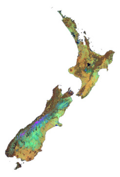
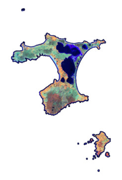
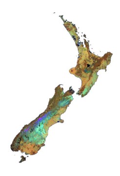
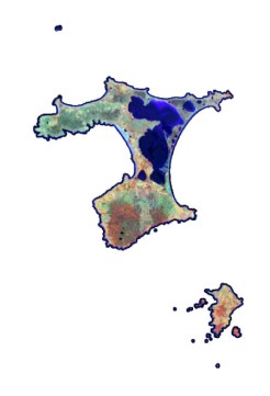
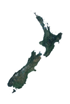
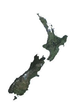
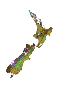
Satellite data search
Here is how organisations can access and use satellite imagery for their own research, monitoring, and reporting purposes.
Here is how organisations can access and use satellite imagery for their own research, monitoring, and reporting purposes.
Organisations can use the national imagery datasets (primarily from satellite) for:
Licensing restrictions vary. Please refer to each dataset description below for details.
“All-of-Government” licensing terms restrict access to central, regional and local governments, universities, and crown research institutes. Controlled access may be granted to contractors of these government bodies on a per-project basis.
Any applicable terms of use and end user license agreements must be signed and strictly adhered to.
Note: The Ministry’s ArcGIS Online site provides public streaming options for Creative Commons datasets.
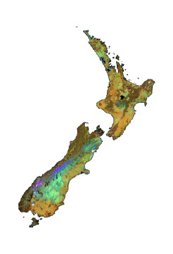
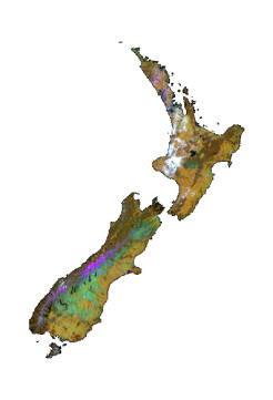
Type: Multispectral
Resolution: 10m
Capture date range: 2 October 2024 to 1 April 2025
Projection: NZTM2000
File format: 2 x TIF (cloud-optimised)
Licensing: Creative Commons Attribution 4.0 International by Ministry for the Environment - Contains modified Copernicus Sentinel data 2024 for Sentinel data
Stream: 3-band Raster Tile Cache (NIR, SWIR, Red)
Download: Email the LUCAS team
More information: Metadata Footprints [MfE Data Service]
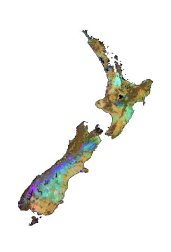
Type: Multispectral
Resolution: 10m
Capture date range: 23 October 2024 to 29 March 2025
Projection: CITM2000
File format: 1 x TIF (cloud-optimised)
Licensing: Creative Commons Attribution 4.0 International by Ministry for the Environment - Contains modified Copernicus Sentinel data 2024 for Sentinel data
Stream: 3-band Raster Tile Cache (NIR, SWIR, Red)
Download: Email the LUCAS team
More information: Metadata Footprints [MfE Data Service]
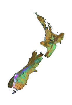
Type: Multispectral
Resolution: 10m
Capture date range: 3 October 2023 to 1 April 2024
Projection: NZTM2000
File format: 2 x TIF (cloud-optimised)
Licensing: Creative Commons Attribution 4.0 International by Ministry for the Environment - Contains modified Copernicus Sentinel data 2024 for Sentinel data
Stream: 3-band Raster Tile Cache (NIR, SWIR, Red)
Download: Email the LUCAS team
More information: Metadata Footprints [MfE Data Service]
Type: Multispectral
Resolution: 10m
Capture date range: 14 September 2023 to 18 April 2024
Projection: CITM2000
File format: 1 x TIF (cloud-optimised)
Licensing: Creative Commons Attribution 4.0 International by Ministry for the Environment - Contains modified Copernicus Sentinel data 2024 for Sentinel data
Stream: 3-band Raster Tile Cache (NIR, SWIR, Red)
Download: Email the LUCAS team
More information: Metadata Footprints [MfE Data Service]
Type: Multispectral
Resolution: 10m
Capture date range: 02 October 2022 to 28 February 2023
Projection: NZTM2000
File format: 2 x IMG
Licensing: Creative Commons Attribution 4.0 International by Ministry for the Environment - Contains modified Copernicus Sentinel data 2023 for Sentinel data
Stream: 3-band Raster Tile Cache (NIR, SWIR, Red)
Download: Email the LUCAS team
More information: Metadata Footprints [MfE Data Service]
Type: Multispectral
Resolution: 10m
Capture date range: 11 October 2022 to 28 February 2023
Projection: CITM2000
File format: 1 x IMG
Licensing: Creative Commons Attribution 4.0 International by Ministry for the Environment - Contains modified Copernicus Sentinel data 2023 for Sentinel data
Stream: 3-band Raster Tile Cache (NIR, SWIR, Red)
Download: Email the LUCAS team
More information: Metadata Footprints [MfE Data Service]
Type: Multispectral
Resolution: 10m
Capture date range: 03 October 2021 to 01 April 2022
Projection: NZTM2000
File format: 2 x IMG
Licensing: Creative Commons Attribution 4.0 International by Ministry for the Environment - Contains modified Copernicus Sentinel data 2022 for Sentinel data
Stream: 3-band Raster Tile Cache (NIR, SWIR, Red)
Download: Email the LUCAS team
More information: Metadata Footprints [MfE Data Service]
Type: Multispectral
Resolution: 10m
Capture date range: 16 October 2021 to 28 March 2022
Projection: CITM2000
File format: 1 x IMG
Licensing: Creative Commons Attribution 4.0 International by Ministry for the Environment - Contains modified Copernicus Sentinel data 2022 for Sentinel data
Stream: 3-band Raster Tile Cache (NIR, SWIR, Red)
Download: Email the LUCAS team
More information: Metadata Footprints [MfE Data Service]
Type: Multispectral
Resolution: 10m
Capture date range: 04 October 2020 to 08 March 2021
Projection: NZTM2000
File format: 1 x IMG
Licensing: Creative Commons Attribution 4.0 International by Ministry for the Environment - Contains modified Copernicus Sentinel data 2021 for Sentinel data
Stream: 3-band Raster Tile Cache (NIR, SWIR, Red)
Download: Email the LUCAS team
More information: Metadata Footprints [MfE Data Service]
Type: Multispectral
Resolution: 10m
Capture date range: 06 October 2020 to 06 February 2021
Projection: CITM2000
File format: 1 x IMG
Licensing: Creative Commons Attribution 4.0 International by Ministry for the Environment - Contains modified Copernicus Sentinel data 2021 for Sentinel data
Stream: 3-band Raster Tile Cache (NIR, SWIR, Red)
Download: Email the LUCAS team
More information: Metadata Footprints [MfE Data Service]

Type: Multispectral
Resolution: 10m
Capture date range: 02 October 2019 to 01 April 2020
Projection: NZTM2000
File format: 1 x IMG
Licensing: Creative Commons Attribution 4.0 International by Ministry for the Environment - Contains modified Copernicus Sentinel data 2020 for Sentinel data
Stream: 3-band Raster Tile Cache (NIR, SWIR, Red)
Download: Email the LUCAS team
More information: Metadata Footprints [MfE Data Service]
Type: Multispectral
Resolution: 10m
Capture date range: 25 October 2019 to 02 February 2020
Projection: CITM2000
File format: 1 x IMG
Licensing: Creative Commons Attribution 4.0 International by Ministry for the Environment - Contains modified Copernicus Sentinel data 2020 for Sentinel data
Stream: 3-band Raster Tile Cache (NIR, SWIR, Red)
Download: Email the LUCAS team
More information: Metadata Footprints [MfE Data Service]
Type: Multispectral
Resolution: 10m
Capture date range: 02 October 2018 to 01 April 2019
Projection: NZTM2000
File format: 1 x IMG
Licensing: Creative Commons Attribution 4.0 International by Ministry for the Environment - produced from European Space Agency remote sensing data
Stream: 3-band Raster Tile Cache (NIR, SWIR, Red)
Download: Email the LUCAS team
More information: Metadata Footprints [MfE Data Service]
Type: Multispectral
Resolution: 10m
Capture date range: 10 October 2018 to 31 March 2019
Projection: CITM2000
File format: 1 x IMG
Licensing: Creative Commons Attribution 4.0 International by Ministry for the Environment - produced from European Space Agency remote sensing data
Stream: 3-band Raster Tile Cache (NIR, SWIR, Red)
Download: Email the LUCAS team
More information: Metadata Footprints [MfE Data Service]
Type: Multispectral
Resolution: 10m
Capture date range: 02 October 2017 to 31 March 2018
Projection: NZTM2000
File format: 1 x IMG
Licensing: Creative Commons Attribution 4.0 International by Ministry for the Environment - produced from European Space Agency remote sensing data
Stream: 3-band Raster Tile Cache (NIR, SWIR, Red)
Download: Email the LUCAS team
More information: Metadata Footprints [MfE Data Service]
Resolution: 10m
Capture date range: 25 October 2017 to 22 February 2018
Projection: CITM2000
File format: 1 x IMG
Licensing: Creative Commons Attribution 4.0 International by Ministry for the Environment - produced from European Space Agency remote sensing data
Stream: 3-band Raster Tile Cache (NIR, SWIR, Red)
Download: Email the LUCAS team
More information: Metadata Footprints [MfE Data Service]
Type: Multispectral
Resolution: 10m
Capture date range: 04 October 2016 to 16 March 2017
Projection: NZTM2000
File format: 2 x IMG
Licensing: Creative Commons Attribution 3.0 New Zealand by Ministry for the Environment - produced from European Space Agency remote sensing data
Stream: 3-band Raster Tile Cache (NIR, SWIR, Red)
Download: Email the LUCAS team
More information: Metadata Footprints [MfE Data Service]
Type: Multispectral
Resolution: 10m
Capture date range: 21 December 2016 to 02 February 2017
Projection: CITM2000
File format: 1 x IMG
Licensing: Creative Commons Attribution 3.0 New Zealand by Ministry for the Environment - produced from European Space Agency remote sensing data
Stream: 3-band Raster Tile Cache (NIR, SWIR, Red)
Download: Email the LUCAS team
More information: Metadata Footprints [MfE Data Service]
Type: Multispectral
Resolution: 15m
Capture date range: 02 October 2015 to 28 March 2016
Projection: NZTM2000
File format: 1 x IMG
Licensing: Creative Commons Attribution 3.0 New Zealand by Ministry for the Environment - Data available from the U.S. Geological Survey
Stream: 3-band Raster Tile Cache (NIR, SWIR, Red)
Download: Email the LUCAS team
More information: Metadata Footprints [MfE Data Service]
Type: Multispectral
Resolution: 10m
Capture date range: 18 November 2015 to 17 March 2016
Projection: NZTM2000
File format: 2 x IMG
Licensing: Creative Commons Attribution 3.0 New Zealand by Ministry for the Environment - produced from European Space Agency remote sensing data
Stream: 3-band Raster Tile Cache (NIR, SWIR, Red)
Download: Email the LUCAS team
More information: Metadata Footprints [MfE Data Service]
Type: Multispectral
Resolution: 15m
Capture date range: 04 October 2014 to 26 March 2015
Projection: NZTM2000
File format: 1 x IMG
Licensing: Creative Commons Attribution 3.0 New Zealand by Ministry for the Environment - Data available from the U.S. Geological Survey
Stream: 3-band Raster Tile Cache (NIR, SWIR, Red)
Download: Email the LUCAS team
More information: Metadata Footprints [MfE Data Service]
Type: Natural Colour (RGB)
Resolution: 1.5m
Capture date range: 26 October 2012 to 01 April 2014
Projection: NZTM2000
File format: 450 x geoTIFF (1:50,000 tiles)
Licensing: NZ Organisations - Airbus DS
More information: Metadata Footprints [MfE Data Service]
Type: Multispectral
Resolution: 15m
Capture date range: 04 November 2013 to 28 February 2014
Projection: NZTM2000
File format: 1 x IMG
Licensing: Creative Commons Attribution 3.0 New Zealand by Ministry for the Environment - Data available from the U.S. Geological Survey
Stream: 3-band Raster Tile Cache (NIR, SWIR, Red)
Download: Email the LUCAS team
More information: Metadata Footprints [MfE Data Service]
Type: Multispectral
Resolution: 10m
Capture date range: 02 October 2010 to 15 March 2013
Projection: NZTM2000
File format: 2 x IMG
Licensing: NZ All-of-Government - CNES
Download: Email the LUCAS team
More information: Metadata Footprints [MfE Data Service]
Type: Multispectral
Resolution: 15m
Capture date range: 03 October 2012 to 01 March 2013
Projection: NZTM2000
File format: 1 x IMG
Licensing: Creative Commons Attribution 3.0 New Zealand by Ministry for the Environment - Data available from the U.S. Geological Survey
Stream: 3-band Raster Tile Cache (NIR, SWIR, Red)
Download: Email the LUCAS team
More information: Metadata Footprints [MfE Data Service]
Type: Multispectral
Resolution: 15m
Capture date range: 04 October 2011 to 29 February 2012
Projection: NZTM2000
File format: 1 x IMG
Licensing: Creative Commons Attribution 3.0 New Zealand by Ministry for the Environment - Data available from the U.S. Geological Survey
Stream: 3-band Raster Tile Cache (NIR, SWIR, Red)
Download: Email the LUCAS team
More information: Metadata Footprints [MfE Data Service]
Type: Multispectral
Resolution: 10m
Capture date range: 21 January 2012
Projection: CITM2000
File format: 1 x IMG
Licensing: NZ All-of-Government - CNES
Download: Email the LUCAS team
More information: Metadata Footprints [MfE Data Service]
Type: Multispectral
Resolution: 10m
Capture date range: 02 October 2010 to 24 March 2011
Projection: NZTM2000
File format: 4 x IMG
Licensing: NZ All-of-Government - CNES
Download:Email the LUCAS team
More information: Metadata Footprints [MfE Data Service]
Type: Multispectral
Resolution: 22m
Capture date range: 22 December 2009 to 06 May 2010
Projection: NZTM2000
File format: 2 x geoTIFF
Licensing: NZ Crown-only - DMC International
Download: Email the LUCAS team
More information: Metadata Footprints [MfE Data Service]
Type: Natural Colour (RGB)
Resolution: 2.5m [synthetic blue band]
Capture date range: 18 January 2008 to 21 June 2009
Projection: NZTM2000
File format: 422 x geoTIFF (1:50,000 tiles)
Licensing: NZ All-of-Government - CNES
Download: Email the LUCAS team
More information: Metadata Footprints [MfE Data Service]
Type: Multispectral
Resolution: 10m
Capture date range: 11 September 2008 to 13 October 2008
Projection: CITM2000
File format: 1 x IMG
Licensing: NZ All-of-Government - CNES
Download: Email the LUCAS team
More information: Metadata Footprints [MfE Data Service]
Type: Multispectral
Resolution: 10m
Capture date range: 03 November 2006 to 11 April 2008
Projection: NZTM2000
File format: 2 x IMG
Licensing: NZ All-of-Government - CNES
Download: Email the LUCAS team
More information: Metadata Footprints [MfE Data Service]
Type: Multispectral
Resolution: 15m
Capture date range: 29 September 1999 to 24 February 2003
Projection: NZTM2000
File format: 2 x IMG
Licensing: Creative Commons Attribution 3.0 New Zealand by Ministry for the Environment - Data available from the U.S. Geological Survey
Stream: 3-band Raster Tile Cache (NIR, SWIR, Red)
Download: Email the LUCAS team
More information: Metadata Footprints [MfE Data Service]
Type: Multispectral
Resolution: 15m
Capture date range: 14 November 1988 to 24 February 1993
Projection: NZTM2000
File format: 2 x IMG
Licensing: Creative Commons Attribution 3.0 New Zealand by Ministry for the Environment - Data available from the U.S. Geological Survey
Stream: 3-band Raster Tile Cache (NIR, SWIR, Red)
Download: Email the LUCAS team
More information: Metadata Footprints [MfE Data Service]