The Te Awa Kairangi/Hutt River has always been prone to flooding and as the most densely populated flood plain in Aotearoa it’s vital damage is minimised from climate change.
Damage, scouring and erosion is already a problem for the state highway that runs alongside much of the river. Parts of the Lower Hutt city centre and the parks and reserves that border the banks of the river are also vulnerable.
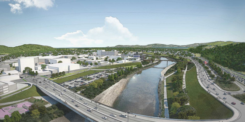
A partnership called RiverLink has been formed between Waka Kotahi NZ Transport Agency, Greater Wellington Regional Council, Hutt City Council and mana whenua Ngāti Toa Rangatira and Taranaki Whānui ki Te Upoko o Te Ika.
The RiverLink project will transform Lower Hutt into a “river facing city” that’s more resilient, connected and vibrant. A major part of that is flood protection.
Flood protection upgrades will include:
- lowering and widening Te Awa Kairangi/Hutt River, giving it more room to flow naturally and allowing more water to pass down the river during floods, as well as enabling more fish habitats to be established
- raising and upgrading the stop banks.
Of course, rivers are something to be celebrated, so the other aspects of the project focus on better transport links, cycling paths and creating a waterfront with cafes, apartments and restaurants.
More information and links: